History of Usery Mountain Regional Park
 The history of the Salt River Valley, and the land that is now Usery Mountain Regional Park, dates back centuries. Early Native American communities developed extensive canal systems to irrigate the desert, supporting thriving agricultural settlements.
In 1867, Jack Swilling, a former Confederate officer and prospector, recognized the potential of these ancient irrigation systems while traveling through the Valley. Inspired by what he saw, Swilling helped establish one of the first modern canals in the area, bringing water to farmland near present-day Phoenix and laying the foundation for future development.
During this time, travel routes between early settlements and Fort McDowell likely passed near what is now Usery Mountain Regional Park, placing the area close to both historic canal remnants and ancient village sites along the Salt River.
The Origin of the Name
Usery Mountain Regional Park, established in 1967, is named after King Usery, a local cattleman active in the late 1870s and early 1880s. Despite his first name, “King” was not a title.
Usery’s life reflected the challenges of the frontier. After struggling to maintain his ranching operations, he moved to the Tonto Basin, where he later became involved in criminal activity. In 1892, he was implicated in the robbery of a stagecoach transporting silver bullion. He was eventually captured, convicted, and sentenced to prison, though he was pardoned after serving part of his sentence.
Following his release, Usery again faced legal trouble related to cattle theft. After serving a short sentence, he disappeared from the historical record.
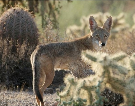
Landscape & Surrounding Region
Usery Mountain Regional Park sits at the edge of a diverse desert landscape surrounded by several notable mountain ranges:
- The Superstition Mountains to the east
- The Goldfield Mountains to the north and northeast
- The McDowell Mountains across the Salt River to the northwest
A broad basin extends to the west and south, shaping the region’s geography and ecosystem.
Pass Mountain, often referred to locally as “Scarface,” is the park’s most recognizable geological feature and a focal point for visitors today.
Historic Travel Routes
Usery Pass once served as an important livestock route, particularly for sheep drives moving between northern Arizona and the Salt River Valley. Mexican and Basque shepherds guided large flocks through the area, creating a seasonal movement that was both economically important and visually striking.
Today, Usery Mountain Regional Park preserves not only the natural beauty of the Sonoran Desert but also the layered history of the people and cultures who have shaped this landscape over time.