Park Overview:
Cave Creek Regional Park covers 2,934 acres near the town of Cave Creek. The park is surrounded by local neighborhoods and state trust land. Elevations range from 2,000 to 3,060 feet, offering wide views of the desert.
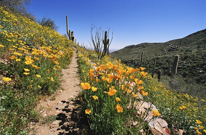
The most popular trail is the Go John Trail. It goes around a mountain and gives visitors the feeling of being far from the city, even though the park is close to town.
Trails:
The park has 16 miles of multi-use trails. Visitors may hike, mountain bike, or ride horses on most of them. Two of the best-known trails are:
- Go John Trail – scenic loop around the mountain
- Overton Trail – another frequently used route with desert views
All trails are shared unless marked otherwise.
Nature Center:
The park’s Nature Center is LEED-certified, meaning it was built to be energy-efficient and environmentally friendly.
The building includes:
- A gift shop
- Live animal exhibits
- Educational displays
- Nature and wildlife information
- Meeting rooms
- Park offices
The Nature Center can also be rented for private events.
Natural Resources:
The park is home to a Palo Verde–Saguaro desert ecosystem. It supports 84 plant species and 69 wildlife species.
Common wildlife includes:
- Coyotes
- Bobcats
- Mule deer
The park also supports less common or protected species, such as:
- Mountain lions
- Desert tortoises
- Crucifixion thorn trees
- Southwestern talus snails
Cave Creek Regional Park is also known for its unique “Michelin” saguaro, named for its rounded, stacked appearance.
Nature-Themed Playground:
To help kids connect with nature, the park features a playground designed with desert themes.
Children can:
- Climb on saguaro-shaped structures
- Explore a spiderweb-style rock wall
- Slide down a mountain-lion-shaped slide
- Play in areas inspired by local wildlife and plants
Park History:
Cave Creek was named for a stream that flows for about 25 miles.
The stream got its name from a large rock overhang that forms a natural cave. People have used this cave for shelter for centuries.
Early Indigenous History
The Hohokam people lived in the area from about 800 A.D. to 1400 A.D. They built homes, farmed the land, and created irrigation systems. Petroglyphs and ruins from this time can still be found.
In the 1400s, Apache groups moved into the region. They lived differently from the Hohokam, relying on hunting, gathering, and small-scale raiding rather than farming.
European Contact
Spanish explorers arrived in the 1500s. They found the desert environment difficult and labeled this part of Arizona “desolate wilderness” on their maps.
Mining and Settlement
Mining became important in the mid-1800s. Gold discoveries in the Bradshaw Mountains led prospectors to explore nearby rivers and valleys, including the Cave Creek area.
However, conflict between settlers and the Tonto Apache occurred often. The Tonto Apache were skilled at moving through the landscape and were hard for soldiers to locate.
Military History
By the 1860s, federal troops established forts, including Fort McDowell, about 18 miles from Cave Creek.
Several battles took place in the area, including skirmishes in 1873.
The Battle of Turret Peak was a major turning point, leading to the eventual relocation of many Apache groups to reservations. After these conflicts, mining and ranching became more common in the region.